Digitally Transforming Water Infrastructure
Pursuing Water and Community Sustainability through the Power of Digital
FUSO's digital transformation (DX) aims to create facilities and systems that lower skill requirements, save labor and manpower, and allow anyone to be involved in operation and management. By transforming traditional processes and methods, we will solve the challenges facing water infrastructure, such as deteriorating facilities, declining birthrates, aging populations, financial difficulties, and technology succession. In addition, by utilizing proprietary digital technology to accumulate information and expertise, more effective asset management is also possible, thereby enhancing the sustainability of the region's water infrastructure. Creating water for a better future: that is FUSO's DX.
- FUSO's Strengths
- Digital Technology for Resolving Local Issues
- Streamlining Operations through Utilization of BIM/CIM
- 3D Modeling in Water Supply and Sewage Infrastructure
- Revizto: An Integrated 2D/3D Communication Tool
- Building Digital Twins for Water Infrastructure
- Use in Digital Transformation
- FUSO's DX in O&M
FUSO's Strengths

Eliminating Skill Requirements
We aim not only for smooth implementation so that anyone can handle tasks, as well as to resolve human resource and technology shortages, but also for reduction in costs.
3D Modeling
Through the creation of digital data utilizing 3D scanners and drones, we visualize water and wastewater infrastructure facilities. This unlocks new possibilities formerly unavailable with paper drawings.

3D/2D Integrated Communication Tools
These integrate three-dimensional and two-dimensional site data to recreate a digital twin online. This facilitates accurate, real-time communication from anywhere.
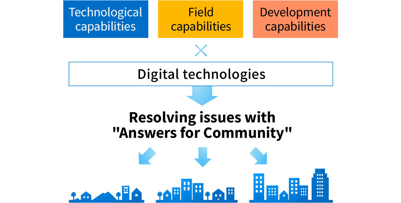
Digital Technology for Resolving Local Issues
The environment surrounding water infrastructure is changing dramatically, and tailor-made solutions are required to sustain water infrastructure in each community. FUSO has built a unique digital technology that enables operation with reduced skill requirements, backed by the technical, field, and development capabilities it has cultivated in various regions as a general contractor for water supply and sewage systems. We have a system in place to ensure that everything from engineering to construction, which also takes into account operation and management, is effective and efficient.
Streamlining Operations through Utilization of BIM/CIM
BIM/CIM as a Communication Tool
FUSO has been studying the use of point cloud data and BIM/CIM (Building/Construction Information Modeling, Management) in actual renovation and renewal work since 2015, prompted by a joint research project with the Japan Sewage Works Agency. For us, BIM/CIM is a communication tool with a high ability to express information and the ability to store large amounts of information. We are working to create solutions to speed up image sharing and consensus building, and to simplify the work of facility builders and users for maintenance, operation, and facility management, by utilizing digital technology that can "connect" beyond time, place, and sites.
What is BIM/CIM?
BIM/CIM (Building/Construction Information Modeling, Management) is intended to facilitate the sharing of information among project stakeholders by introducing 3D models from the planning, survey, and engineering stages, and by linking and developing 3D models in the subsequent construction and maintenance stages, thereby streamlining and evolving the set of construction production and management systems.
BIM/CIM is an abbreviation for Building/Construction Information Modeling and Management, and has been promoted by the Ministry of Land, Infrastructure, Transport and Tourism since 2018. Overseas, "BIM" means 3Dization of the entire construction field, and its use in the civil engineering field is called "BIM for infrastructure" and is recognized as a part of BIM. Therefore, the conventional concepts of "BIM" in the architectural field and "CIM" in the civil engineering field have been revised, and the name for the entire 3Dization of terrain, structures, etc. has been clarified to "BIM/CIM."
What is Point Cloud Data?
A set of data points composed of three-dimensional coordinates, possessing both position information (X, Y, Z) and color information (R, G, B). This imported data shows the "real" shape of the target, including topography and objects, and is saved in the form of point cloud data consisting of a vast series of points, and can be processed by PCs and other devices. It is notable in the speedy and accurate values compared to conventional field surveying.
Traditional Issues Solvable by BIM/CIM
Japan faces the issue of deteriorating water supply and sewage infrastructure facilities. As a result of numerous renovations and upgrades that have taken place in the past, it is not uncommon for design drawings to not exist or, if they do exist, to differ from the current reality. In such cases, it takes a great deal of time and effort to understand the complex and intricate current situation. In addition, there is the problem that it is difficult to pass on the knowledge, experience, and skills of those who are familiar with the current situation and the field to those who come after them. FUSO has been promoting the construction, operation, and maintenance of renovation and upgrade projects by utilizing point cloud data and BIM/CIM to capture the site as it really is. The 3D visualization technology offered by point cloud data and BIM/CIM enables quick decision making and smooth consensus building among stakeholders, as well as accurate understanding of the current status among the stakeholders and saving accurate data about the current situation.
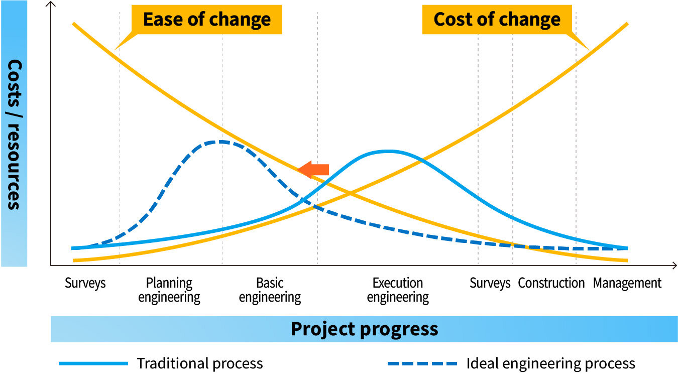
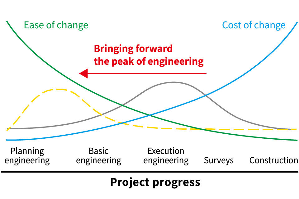
Mitigating Risk through Front-loading
By utilizing BIM/CIM-related technologies*, each process, such as site surveys, creation of 2D drawings, and construction planning, can proceed simultaneously. In addition, front-loading prevents specification changes and rework that may occur in later processes, improving quality and significantly reducing construction time.
*Revit® is a registered trademark of Autodesk, Inc.
Efficiency through Autogeneration
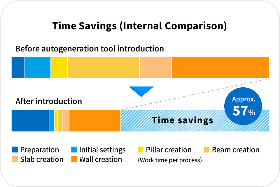
When designing structures with BIM/CIM, we are using tools to automate portions of the design process that have traditionally relied on manual work. This automation is made possible by a newly-developed add-in that brings new functionality to Revit®, the BIM/CIM software. It enables the automatic generation of 3D models based on 2D drawings, replacing the manual process of placing individual objects, such as beams and columns, in 3D space. This results in significant efficiency gains in the design workflow.
Video: BIM/CIM as a Foundation for Construction and Management Innovations
3D Modeling in Water Supply and Sewage Infrastructure
3D modeling produces a faithful digital recreation of the visually-observable portions of water supply and sewage infrastructure facilities. It achieves this by using a stationary laser-based 3D scanner for interiors, and using photogrammetry from images taken by drones for exteriors, converting these into point cloud data. This visual representation of the interior and exterior of facilities using 3D models helps establish a greater big-picture understanding than with design documents and other drawings alone. Fusing these 3D modeling services with BIM/CIM construction and operations, an area where FUSO has a great deal of accumulated expertise, offers a great deal of benefits for those building managing, and maintaining facilities. Not only does it accelerate and streamline the sharing of visual concepts and the building of consensus, but it also empowers maintenance and operation work, providing centralized records, enabling remote control, and increasing efficiency and sophistication.
3D model data of water supply and sewage infrastructure (left: exterior; right: interior)
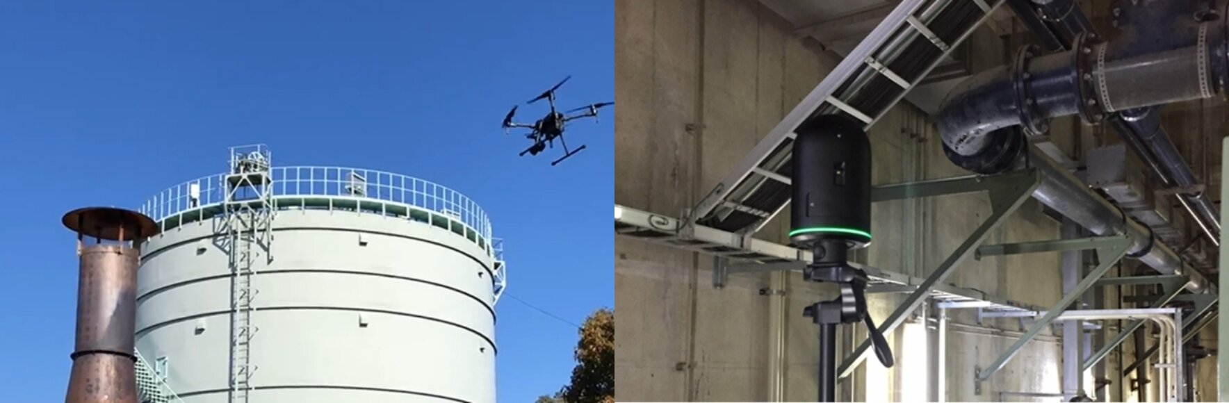
A drone (left) and 3D scanner (right) capturing facility images
Video: FUSO's 3D Modeling Service
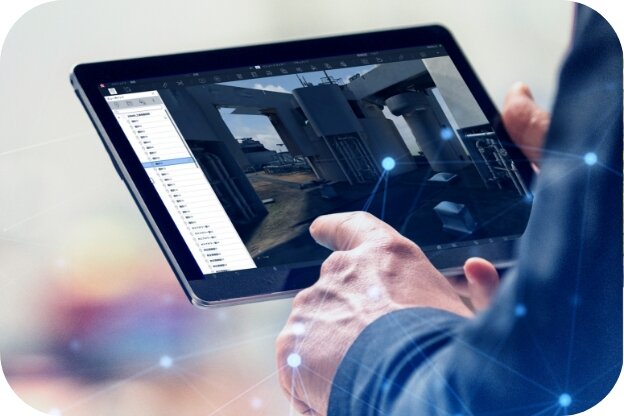
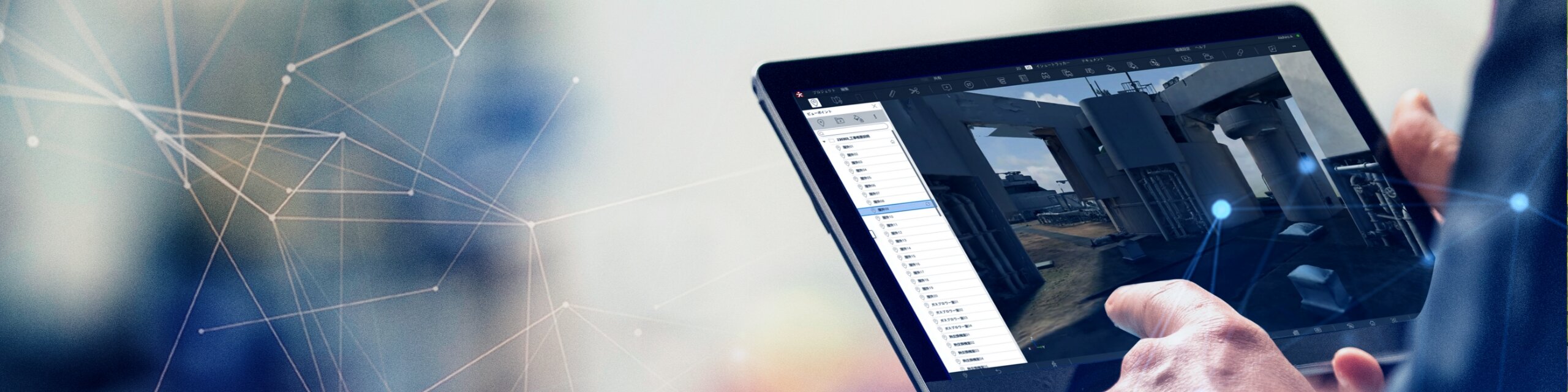
Revizto: An Integrated 2D/3D Communication Tool
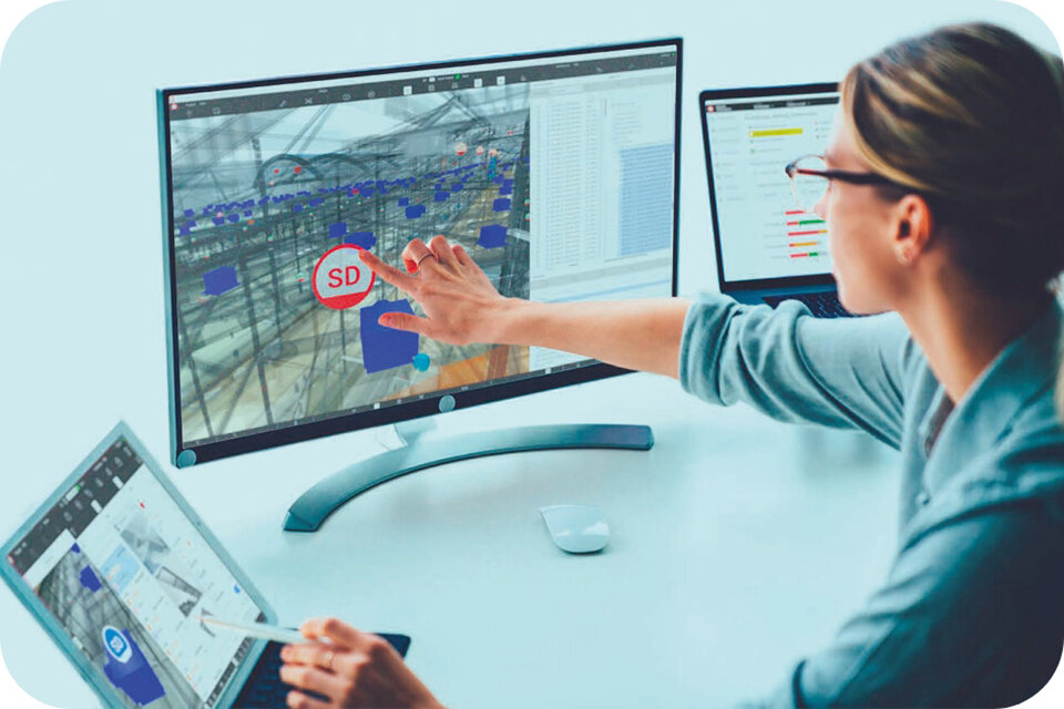
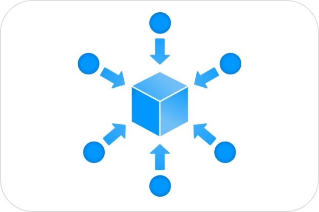
Revizto is a platform tool that integrates 3D data (point cloud data and BIM/CIM), 2D data (drawings), and field information to recreate the site online and facilitate accurate, real-time communication among all parties involved. Use of this tool on a PC or tablet lets users easily communicate with other project members by integrating, viewing, and writing the necessary data without complicated steps.
It enables the centralized storage of information necessary for design and construction sites, and accelerates the sharing of visual concepts and the building of consensus among those involved. This creates a kind of collaboration that transcends the boundaries of fields and professions, regardless of which devices or skills the user has.
Visualizing Issues and Status in 2D and 3D
Facilitating Collaboration
By enabling collaboration between all stakeholders at any time, we can resolve a variety of communication issues that frequently arise in construction projects.
Unified Application
It is possible to centrally manage not only BIM/CIM model data, but also documents created in PowerPoint, Excel, and other formats. Data can be checked and shared by all stakeholders at any time, leading to early detection of issues.
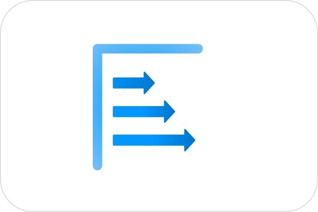
From Planning to Construction and Management
This platform can be utilized throughout the construction process, from the planning stage to basic engineering, execution engineering, construction, and maintenance and management such as repairs, additions, and renovations.
Core Benefit of BIM/CIM
Efficient and real-time communication during engineering and construction is essential to a project. The use of Revizto by all stakeholders delivers tangible benefits, including via front-loading.
Use Cases
1) Site and Design Drawing Discrepancy Checks
Discrepancies are identified by overlaying the point cloud data acquired in the field with the design drawings. This helps to identify problems and risks as early as the design stage, allowing teams to take action to improve design quality. Revizto also helps to reduce omitted communication with its notes function.
2) Remote Communication
Revizto facilitates communication between construction sites and offices in remote locations through its easy-to-use commenting and document transfer functions. Since it serves as a centralized hub for information key to all stakeholders, it helps streamline operations.
3) Providing Information About Lifetime Facility Management
Revizto serves as a platform for integrating traditional data, like drawings and facility ledgers, with three-dimensional data. Its design allows users to easily add or obtain important information for facility management. This access to accurate information helps achieve more sophisticated facility management.
Video: Strengths of Revizto
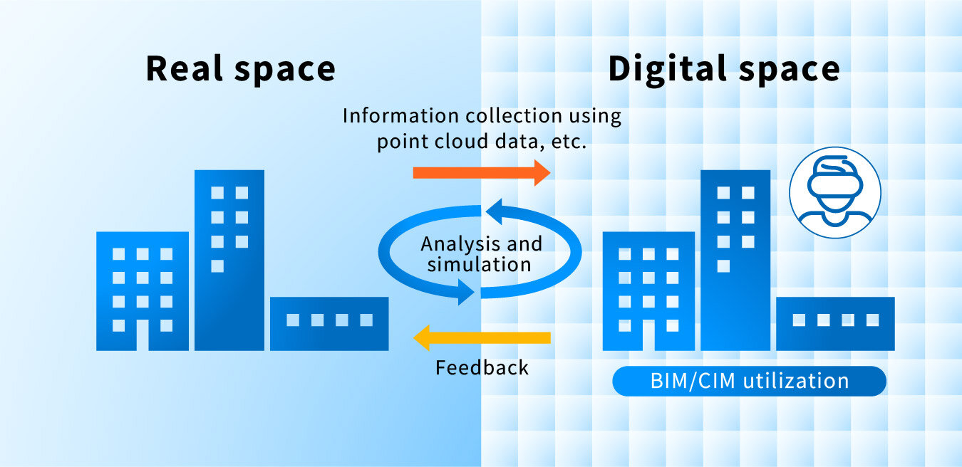
Building Digital Twins for Water Infrastructure
FUSO aims to be the most digitally-enabled company in the water supply and sewage sector. The key to this establishing what is called a "digital twin" of water infrastructure. A digital twin is a technological recreation of real (physical) space in digital (virtual) space through the collection of various physical data. This allows, for example, meetings in VR (virtual reality) utilizing FUSO's BIM/CIM services and VR goggles. This enables water infrastructure support that is not limited by time and location. Representing complex drawings in a VR space not only improves the accuracy of understanding and ascertaining fact, but also facilitates access from remote locations. Our aim is to create digital twins where the water infrastructure of each region is reproduced in a digital space and can be accessed from anywhere and communicated with anyone.
Use in Digital Transformation
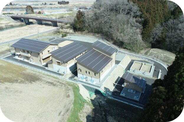
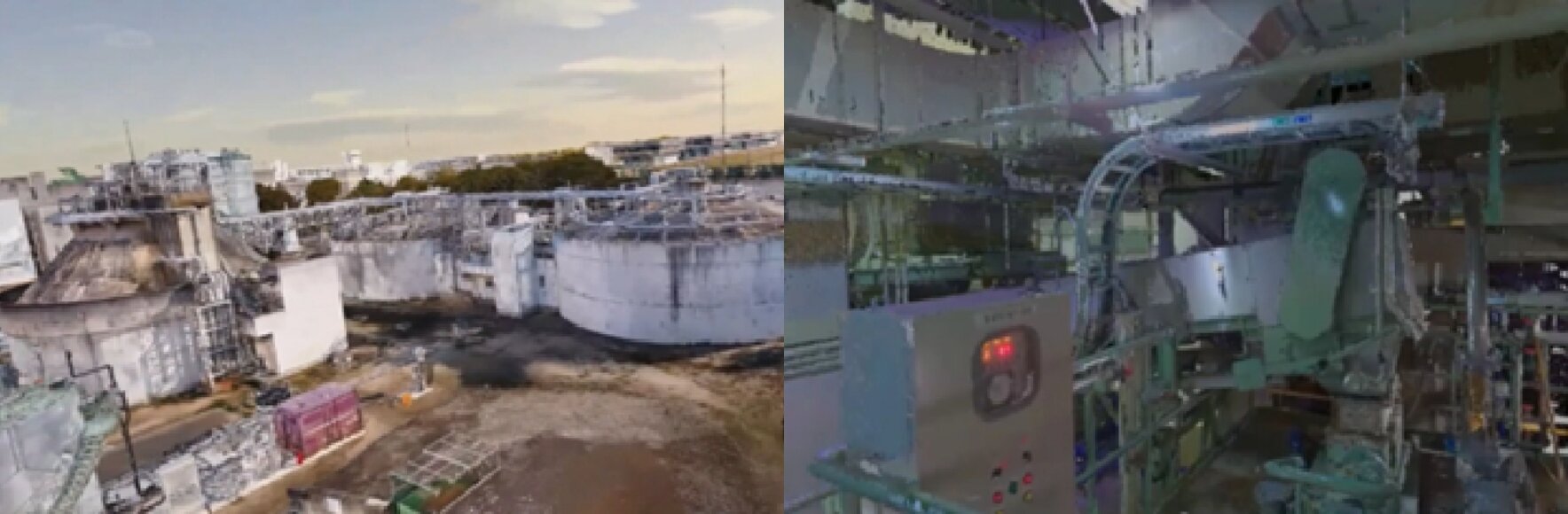
Upgrade project for machinery located in a rainwater sedimentation basin at the Kishibe pumping station in the Ai River basin sewage system
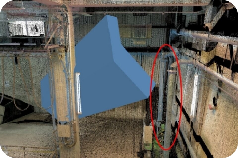
Resolving Problems in Pre-construction Stages Using 3D Modeling
By using a system whereby orders for construction were to utilize existing design deliverables from similar facilities and modify these partially to adapt them to the job at hand, we handled all processes from design content revision to EPC. We carried out 3D modeling of the construction site, as it was necessary to rapidly understand and construct the site in order to carry out engineering verification and change consultation at the same time. FUSO rapidly obtained accurate on-site data, reflecting its understanding in construction planning and equipment design to improve the efficiency of design and construction. Even amid the highly restrictive COVID-19 pandemic and at a site with limited space, we successfully completed the expected processes in less than a year. The image provided here is from a simulated equipment delivery by integrating point cloud data and BIM/CIM models.
FUSO's DX in O&M

Unlocking potential in maintenance and management through handling all processes
Unlocking potential in maintenance and management through handling all processes
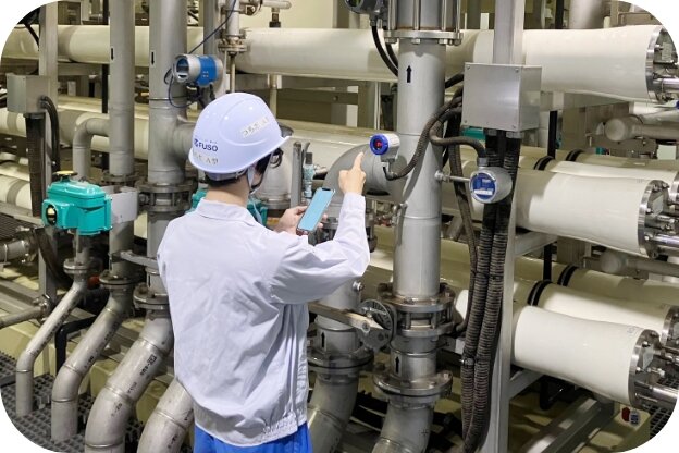
Our strength is that we are a one-stop provider for engineering, construction, and subsequent maintenance and management. In the maintenance and management area, we are actively introducing DX to solve various issues for our customers.